


List of relic sites (42)

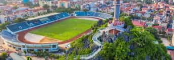
Dong Hoi ancient citadel
Dong Hoi Ancient Citadel is a part of the overall historical military relics of Dong Hoi during the Trinh-Nguyen conflict period, built on a key land area of the trans-Vietnam road from North to South. Along with its favorable geographical position, bordering the Nhat Le river and estuary on the East, serving as both a place for reinforcements and contributing to stopping the enemy's waterway attack, this place has marked many events. important history, marking the victory in the Northern advance of the 9 Nguyen Lords, ending 200 years of civil war. At the same time, Dong Hoi citadel also marked many victories of the army and people of Quang Binh through two holy resistance wars of the nation. Dong Hoi Citadel was started construction in the 10th year of Gia Long (1812). The citadel was built on the land where Lord Nguyen Phuc Nguyen built Tran Ninh fortress (also known as Dao Duy Tu fortress - 1631) and Dong Hai fortress (1774) during the Trinh-Nguyen war. At first, the citadel was built of earth, but during the reign of King Minh Mang, he asked a French officer to redesign it and build it with bricks in 1824 according to the tapeless architecture, with the appearance of a military citadel, in the shape of a notch. 4 big zones, 4 small zones in the southwest-northeast and northwest-southeast directions. The citadel has 3 large gates north-south-east, on the gate there are 8-roof watchtowers, the citadel gate is built in a three-door style, connected to the outside by a brick bridge also built in an arch style across the moat. Outside the citadel, about 5-6m from the citadel is a 7 truong (28m) wide moat, the outside of the citadel is covered with additional 3 truong of soil, the citadel is built of bricks, mortar made of molasses mixed with sand, not plastered, bricks are baked. tall, large bricks are also called mallet bricks. In the year of the Tiger, 1842, King Thieu Tri, on his way to the North, passed the Tran Ninh citadel, changed its old name to Dinh Bac Truong Citadel and had it repaired. In 1885, the French colonialists attacked the Central region, Dong Hoi citadel became a place of defense and counterattack of the Nguyen Dynasty's army. On July 19, 1885, the French colonialists attacked Dong Hoi citadel for the second time and the citadel fell into French hands. During the Can Vuong movement, the army and people of Quang Binh joined the insurgent army led by Nguyen Pham Tuan who broke into Dong Hoi citadel three times in January, June, and August 1886 to attack French soldiers, causing them many losses. the seventh. During the anti-French period, Dong Hoi citadel was a place to gather soldiers, a rendezvous point for people who dared to live and sacrifice for the Fatherland. Most of Dong Hoi citadel was destroyed during the French colonial period. In the resistance war against the US, with the purpose of leveling and destroying, turning this place back to the Stone Age to prevent reinforcements from the Northern rear to the Southern battlefield, US imperialism rained down on Dong Hoi. tens of thousands of tons of bombs and ammunition and destroyed part of the ancient citadel. Today, Dong Hoi citadel is only about 1,087m long with 15 zigzag sections in the shape of star teeth. The southern part of the citadel has 2/3 remaining relatively intact, the eastern part of the citadel has 3 gates, 2 south and north bridges have collapsed. Completely, the clearest view from the map is a moat around the citadel according to ancient architecture. Although much destroyed during two wars, Dong Hoi citadel still retains its essential original elements. According to the assessment of researchers, over time Dong Hoi citadel has been a witness and also a historical record marking a period of heroic struggle of the people of Dong Hoi - Quang Binh and the whole country in the fight against enemies. inside and outside to protect the integrity of Vietnam's territory. With its importance as a relic that has existed for more than 200 years, and is an important historical evidence of the land of Dong Hoi - Quang Binh, the Ministry of Culture, Sports and Tourism has classified Dong Hoi as one of 32 works. in the list of key cultural projects invested in from 2001-2010. Source: Quang Binh Newspaper
Quang Tri
4957 view
Rating : National monument

Historical relic A72 information station Quang Binh a72 information station
General Information Station A72 is located in the cave system of An Bo mountain, Ngan Thuy commune, Le Thuy district, Quang Binh province. This is the place that marks the silent victories, the spirit of determination to win, not afraid of hardships and sacrifices, and the resilient will of communication officers and soldiers in the people's resistance war against America to save the country. our clan. A72 is an important general station of Information Regiment 136, Communications Command, located in the An Bo mountain area, Ngan Thuy commune (Le Thuy) during the resistance war against the US to save the country. In the years 1966-1967, when the resistance war against the US to save the country entered a new, more drastic phase, the Ministry of Defense decided to build an additional communication line from North Nghe An to the northern bank of Ben Hai River. From this axis there will be many branch roads radiating to the areas for the General Command of the Vietnam People's Army to directly direct the southern fronts of Military Region 4, the Tri Thien front, and the Truong Son Army Command. (Group 559), Transport Group 500 of the Ministry of Transport and the Southern Laos front. Accordingly, the Department of Information and Communications (the predecessor of the later Communications Command) decided to establish Company 7 under the 136th Information Regiment, managing and exploiting the bare wire line of more than 300 kilometers. from Giang Son-Nghe An to high point 316-Vinh Linh. This route has 3 service stations, all in Quang Binh: A69 in Len Ha - Tuyen Hoa; A70 in Khuong Ha-Bo Trach and A72 in An Bo-Le Thuy. On January 7, 1967, at An Bo mountain cave, Ngan Thuy commune, General Information Station A72 of Company 7, Regiment 136, Communications Command was established. The A72 service station has up to 50 high-frequency telephone circuits, 28 three-way locomotives of various types and 2 100-digit switchboards. In addition to the task of ensuring communication for battlefield directions, A72 is also a reception station for agencies of the Ministry of Defense and high-ranking envoys of the Party and State to directly monitor and direct campaigns. This place became the campaign command center. The work of officers and soldiers of Station A72 increased by 7-8 times compared to normal. General Commander-in-Chief Vo Nguyen Giap was in the cave in the Command Post, General Information Station A72 area, with the generals who directly commanded our troops and people to fight in the "Road 9-Southern Laos Campaign". history. Completely defeated "Operation Lam Son 719" by the US imperial army and the puppet troops of the Saigon government. A resounding, most heroic victory in the history of our nation's resistance war against America. Including the significant contribution of officers and soldiers of General Information Station A72, ensuring absolute safety for the Command Post of General Commander-in-Chief Vo Nguyen Giap, maintaining communication in all situations. most fierce. In December 1982, in response to the need for force organization, the Ministry of National Defense merged Regiment 136 into Regiment 134, unifying the task of ensuring wired communication from the North to the Central region. From 1967 to 1982, General Information Station A72, Company 7, Regiment 136 has grown significantly, successfully completing the task of ensuring communication, contributing to the fighting career of building the Information Force. heroic communications, heroic Vietnamese People's Army. The regiment was awarded the First Class Victory Medal by the Party, State and Army; Company 7 was awarded the title of Hero of the People's Armed Forces; The A72 Information Station in Ngan Thuy commune was awarded the title of National Historical-Cultural Monument by the State. Source: Quang Binh Tourism Newspaper
Quang Tri
4613 view
Rating : National monument

Mausoleum of Nguyen Huu Canh
Nguyen Huu Canh's mausoleum is located on a high, airy hill of the An Ma mountain range in Truong Thuy commune, Le Thuy district. Nguyen Huu Canh was a mandarin who had great contributions under Lord Nguyen in fighting the enemy, opening up the land, and shaping the Vietnamese territory into a unified country. Nguyen Huu Canh was born in 1650 in Phuoc Long village, Chuong Tin, Phong Loc district (now Van Ninh commune, Quang Ninh district, Quang Binh province). He was awarded the title Le Thanh Marquis, Khai Quoc Cong Than, listed as the Superior Cong Than and worshiped at Thai Mieu. Nguyen Huu Canh is the third child of famous general Nguyen Huu Dat. Belonging to the lineage of the general's family, his ancestor was Dinh Quoc Cong Nguyen Bac, - the founder of the country during the Dinh dynasty. – Nguyen Huu Canh is also the 9th generation grandson of Nguyen Trai, – the founder of the Le Dynasty. Born in a traditional family and raised during the Trinh - Nguyen period, Nguyen Huu Canh's talent was soon revealed. At the age of twenty, Nguyen Huu Canh was famous throughout the region for his excellent martial arts skills. He followed his father to fight everywhere and made many achievements, so Lord Nguyen conferred the position of Cai Co. He has a heroic physique, dark skin, and was born in the year of the Tiger, so people call him by the nickname "Black Tiger". History also records that he many times led troops to suppress the Champa Dynasty and harass the South. In early 1692, Lord Nguyen sent Nguyen Huu Canh as General of the Army along with advisor Nguyen Dinh Quang to bring troops to balance the border and establish Thuan Thanh town (present-day Ninh Thuan, Binh Thuan). As soon as pacification was completed, a group of Qing people, led by Aban, incited factions to rebel. Nguyen Huu Canh received orders to suppress the rebels, bring security to the people of the county and was appointed to guard Binh Khuong palace (also known as Binh Khang, now Khanh Hoa - Binh Thuan region). In 1699, Chan Lap King Nac Thu (some books say Nac Ong Thu) led his army to attack Dai Viet. Lord Nguyen Phuc Chu sent Nguyen Huu Canh as the army commander, taking care of defeating and pacifying the people. Nguyen Huu Canh went straight to La Bich citadel (Nam Vang), defeating Nac Thu's army. In April of the year Canh Thin (1700), Nguyen Huu Canh fell ill. May 16, 1700. Nguyen Huu Canh died in Sam Giang (Rach Gam). In 1802, Nguyen Huu Canh's remains were brought back to be buried by descendants in Truong Thuy commune. Currently, in the grounds of Nguyen Huu Canh's Tomb in Quang Binh, there is a very valuable stone stele. Nguyen Huu Canh's tombstone is about 1.2m high, carved from green stone (marble). After his death, the people of the South in general and especially the Mekong Delta provinces set up temples to worship him in many places. Although several centuries have passed, the name and career of Nguyen Huu Canh are still forever engraved with the Vietnamese people in general and the people of Quang Binh in particular. "Thanh Marquis Cong Le went to open the land, thousands of years later, descendants will always remember" On March 25, 1991, Nguyen Huu Canh's mausoleum was ranked by the State as a national historical relic. Source: Quang Binh Tourism
Quang Tri
4913 view
Rating : National monument

Da Deo Pass
Da Deo Pass is located on the legendary Eastern Ho Chi Minh Trail associated with Vietnamese history. The 17km long pass is located in Thuong Hoa commune, Minh Hoa district, Quang Binh province. The reason people call it Da Deo Pass is because the pass lies across the top of a limestone mountain more than 10 km long. In the past, it was just a small trail, but during the Vietnam War, heroic youth volunteers opened Truong Son Road, a vital road for transporting troops, food, weapons... to support the war. Southern school. The people who went ahead carved stones to pave the way for our troops to follow, and that's why it was called Da Deo Pass. The terrain in Da Deo Pass area is quite diverse with alternating hills and valleys and divided by high mountains on one side and deep abysses on the other. The pass has sharp curves, quite steep slopes, and a lot of erosion. The climate here is extremely harsh with Laotian wind, scorching sun, constant rain and floods... During the war years, Da Deo Pass was one of the fiercest spots, bombarded day and night. Fighter planes and B52s bombed continuously, in addition to artillery from the US 7th Fleet firing from the East Sea. This place seemed to have been flattened to the ground by enemy bombs. Countless young volunteers have fallen to ensure traffic on key roads. The war is so cruel, the bombs are so fierce, but Da Deo Pass still stands tall and proud. With bare hands, not afraid of the hardships and dangers of soldiers and young volunteers. All with the spirit of "blood can be spilled, roads cannot be blocked", after the sound of the bomb stopped, all the brothers and sisters rushed to the street to fill the bomb hole and repair the damage. When the industrialized and modernized Ho Chi Minh Trail was built, Da Deo Pass was renovated and upgraded. Becoming a very meaningful tourist route to visit ancient battlefields. Right at the top of the pass, there is still a stone stele marking the historical period: "Da Deo Pass was the focus of fierce bombardment by the US Air Force from 1965 to 1972". When passing through Da Deo Pass, we can feel some of the brutality of war, and also commemorate the children who sacrificed for the cause of national liberation. The heroic stories and legends here will be passed on forever into the future. Right at the foot of Da Deo Pass is Cha Noi Valley, a beautiful wild scene. Nestled next to the majestic limestone mountains in Phong Nha Ke Bang, there are rivers and streams, surrounded by mist. Source: Quang Binh Tourism
Quang Tri
5025 view
Rating : National monument

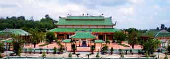
Hoang Phuc Pagoda
Hoang Phuc Pagoda originated as Tri Kien pagoda, Kinh Thien pagoda, commonly known as Tram pagoda or Quan pagoda, in Thuan Trach ward (now My Thuy commune), Le Thuy district, Quang Binh province. After more than 700 years of history, Hoang Phuc Pagoda still exists and develops with many restorations and restorations. In 1609, Lord Nguyen Hoang rebuilt the pagoda on the old foundation and named it Kinh Thien In 1716, Lord Nguyen Phuc Chu visited the pagoda, repaired it, placed two horizontal panels representing "Kinh Thien Tu" and "Unparalleled Blessed Land", and controlled 5 pairs of tureens hanging in the pagoda. In 1821, King Minh Mang visited the pagoda and changed the pagoda's name to "Hoang Phuc Tu". In 1823 and 1826, the king gave 250 taels of silver to repair the pagoda. In 1842, King Thieu Tri, who lived in Bac Tuan province, visited Hoang Phuc pagoda and granted 300 taels of silver to restore the pagoda. Hoang Phuc Pagoda is not only a place to worship Buddha, a place to propagate Buddhism, but also a place associated with typical historical events of the homeland through the ages. During the pre-uprising period, with its location in a semi-mountainous area, surrounded by luxuriant trees and bordering My Tho - Trung Luc, the first Communist Party cell in the south of Quang Binh province was born (1931). ). Hoang Phuc Pagoda has become a revolutionary base, harboring and protecting cadres who come here to operate. Especially in 1943, comrade Bui Trung Lap, an officer of the Central Party Committee, also came here to meet with revolutionary cadres and propagate the Party's policies and fighting spirit to the masses. In early May 1945, according to the instructions of the superiors, the Village Uprising Campaign Committee was established, Hoang Phuc Pagoda was chosen as the meeting place to implement the superiors' uprising instructions and prepare forces. weapons led to an uprising to seize power on August 23, 1945. During those years of fierce struggle, Hoang Phuc Pagoda was a place to hide weapons, a place to recruit and train militia and self-defense forces, and a place where higher-ranking military officers gathered and organized raids. locally, contributing to the overall victory of the resistance war against the French colonialists in Quang Binh. During the resistance war against the US to save the country, My Thuy was one of the communes directly adjacent to the major southern front line. This is the rear base of battlefield B, a gathering place for goods, weapons, and a stopping point before entering the Southern battlefield. Buddhists in Hoang Phuc Pagoda joined local people in fighting and serving in local battles. In 1967, Hoang Phuc Pagoda was destroyed by bombs and bullets after American air strikes. Previously, the system of worship statues at Hoang Phuc Pagoda had quite a large number, designed on 7 worship levels. However, currently the pagoda only has 7 statues of various types with different materials, manufacturing techniques, designs and decorative arts. Among them, there are 5 bronze statues and 2 wooden statues. In particular, the pagoda also preserves a large bell cast in the 20th year of Minh Mang's reign (1839) named Hoang Phuc Linh Chung. In November 2014, the restoration project of Hoang Phuc Pagoda was carried out according to the ancient pagoda style of the Tran Dynasty, including: Three external gates, Three internal gates, Buddha tower, Three jewels, Patriarch church, left and right corridors, gold ammification and other auxiliary works. With the historical values of the pagoda, on December 9, 2015, the Ministry of Culture, Sports and Tourism ranked Hoang Phuc Pagoda as a National Historical Site. Source: Quang Binh Tourism
Quang Tri
4707 view
Rating : National monument
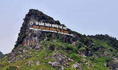
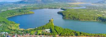
Phong Nha - Ke Bang National Park
Phong Nha Ke Bang National Park Relics is located in the mountains of Central Vietnam, a natural wonder located southwest of the Gianh River. With a unique geographical location, Phong Nha Ke Bang National Park relic borders Laos to the West and Southwest; The north borders Thuong Hoa commune, Minh Hoa district; The Southeast borders Truong Son commune, Quang Ninh District, Quang Binh province. Phong Nha Ke Bang National Monument is not only the largest limestone mountain in the world; This place also possesses magnificent caves, mysterious rivers and beautiful waterfalls. From famous caves known since the 1920s and exploited for tourism since the French colonial period, to recent discoveries from the British Royal Cave Expedition, this monument still fascinates people. fascinated by the beautiful scenes that nature bestowed on this place. The cave system in Phong Nha Ke Bang National Park is the oldest cave in Southeast Asia, with natural impacts from more than 35 million years ago. This is also where diverse ecosystems are formed thanks to the largest limestone block in Southeast Asia, creating favorable conditions for the development of primary forests. With more than 15 habitat types and 10 important vegetation types, Phong Nha Ke Bang covers 83.74% of its area with primary forest. What makes Phong Nha Ke Bang relic stand out is not only its poetic natural landscape, but also its biodiversity. With more than 2,600 species of plants, 735 species of vertebrates and 369 species of insects, including many rare species listed in the red book. This place is also home to many endemic species of primates and bats, contributing to making the ecosystem here rich and diverse. In addition to biological value, Phong Nha Ke Bang National Park relics also preserve many historical relics. From ancient cultural vestiges of the Cham people, ancient Vietnamese, to memorabilia of the resistance war against the French and Americans. All of this has given the Phong Nha Ke Bang relic immense historical and cultural value. Thanks to that, in July 2003, Phong Nha Ke Bang national park relic was recognized by UNESCO as one of the world's natural heritage sites. On August 12, 2009, the Prime Minister of Vietnam recognized Phong Nha Ke Bang National Park relic as one of the Quang Binh historical relics ranked as a special national historical relic. Source: Quang Binh Tourism
Quang Tri
4594 view
Rating : Special national monument
Outstanding monuments
See all
Trung Thuan War Zone
Trung Thuan war zone is located in the semi-mountainous area of Quang Luu and Quang Thach communes, Quang Trach district, about 5 km west of Ba Don town. Once an important revolutionary base for the army and people of Quang Trach during the resistance war against the French colonialists and American imperialists, Trung Thuan war zone has become a heroic historical testimony and the pride of every person. people around here. Trung Thuan War Zone is a national historical relic site in 1995. The war zone is located on the area of two communes, Quang Luu and Quang Thach. However, the main area still belongs to Quang Thach commune. The ancient Trung Thuan war zone was a valley surrounded by many high mountains and dense forests in a U shape. In the war zone, there was Chop Chai peak, nearly 1,000m above sea level, which became an ideal "observatory" for the soldiers. the whole region. In small hamlets of Trung Thuan such as Duong Khe, Ha hamlet, Xuan Vuong, Kim Thanh, Tam Da, Trung Chinh, Tien Mieu, Dinh Cu, Phu Luu, Van Tap... Archaeologists have discovered many Archaeological artifacts such as: Phu Luu bronze drums, Dong Son type I bronze drums, bronze fish hooks, bronze axes and traces of Lam Hamlet ruins. Trung Thuan during the Trinh - Nguyen conflict period was a large base of the Trinh army north of the Gianh River. Dai Don base (Trung Thuan) along with Roon station and Thuan Bai station were important strategic defense lines of the Trinh army. In the north of Gianh River, the remaining vestiges are Tau Voi well, Vong Bai island... During the Can Vuong period, Trung Thuan was the base of Le Truc's insurgent army in the Can Vuong movement against the French in Quang Binh. Trung Thuan is an important base in the entire Can Vuong base system such as Huong Son, Huong Khe (Ha Tinh), Quy Dat, Khe Ve..., the remaining vestiges are Bai Tap, Bach Thach, Linh Than, Fish pond, Grinding stone slot, Tien Mieu hamlet, Xuan Vuong hamlet. During the resistance war against the French colonialists, the Trung Thuan war zone was not only the place where the District Party Committee, the Administrative Committee and the headquarters of Quang Trach district worked, but also the place where they trained and prepared the uprising forces to seize power. power and additional forces to jointly defend Vo Xa to seize power in Dong Hoi town in August 1954. During the resistance war against America to save the country, Trung Thuan was the rear base of the B70 Corps of the Vietnamese People's Army. This is a transit point in the Ho Chi Minh road system to support human and material resources for the struggle to liberate the South and unify the country. Due to its important role, in 1968 and 1972, the Trung Thuan war zone was heavily bombarded by American aircraft. Local soldiers and people sacrificed a lot, however, with their stubborn will, that still did not shake the revolutionary spirit of the army and people here. With his important contribution, in 1971, Trung Thuan war zone was honored to welcome General Vo Nguyen Giap to visit and summarize the victory of Route 9-Southern Laos. Source: Quang Binh Newspaper
Quang Tri
8164 view
Rating : National monument

DOC MIEU MILITARY BASE
Doc Mieu military base is located in Gio Phong commune, Gio Linh district, Quang Tri province. This historical site is quite famous and is considered an "impregnable fortress" during the resistance war against the French colonialists and American imperialists. Located east of National Highway 1A, about 7km south of Hien Luong Bridge, Doc Mieu is a basalt hill located in a terrain area consisting of three zigzag slopes. This is also the defense line built by the US called Namara - the name of a general commanding the US - Puppet army, to prevent all reinforcements from the North and the Southern battlefield. Among them, Doc Mieu military base is the most important base in this line. Here, the enemy built a system of vaulted tunnels and mobile blockhouses made of concrete. Along with that is an artillery battle towards the north bank of the Ben Hai River, a control center to protect the fence, an armored patrol squad, and many American and puppet companies deployed. Surrounding the base are barbed wire fences with 12 layers of 3m high, on top is a fence with automatic mines, under the fence is a dense minefield hundreds of meters wide. In 1972, our army and people simultaneously opened fire, fired DKD grenades, A12 grenades, and rocket launchers, surrounding the Doc Mieu military base. After three consecutive days of attacks, the enemy had to flee on the night of March 31, 1972, leaving behind their posts, associates, and modern electronic fence system. Currently, our government built a victory monument to recognize the soldiers who fought heroically. At the foot are long, straight rubber hills, proof of the vibrant revival of life in this once-torn land. Doc Mieu military base relic has become a historical tourist attraction for tourists to visit every time they come to Quang Tri. This is not only a symbol of our nation's indomitable fighting spirit but also has profound educational significance for the country's future generations. Source: Quang Tri Newspaper
Quang Tri
8020 view
Rating : National monument

Truong Son National Martyrs Cemetery
Truong Son Martyrs Cemetery is located on Ben Tat hill, next to National Highway 15, in Vinh Truong commune, Gio Linh district; about 38km northwest of the provincial center (Dong Ha town); about 20km northwest of National Highway 1A (in Gio Linh district town). After the day of national reunification, the Party Central Committee and the Ministry of National Defense approved the project to build the Truong Son martyrs cemetery in Quang Tri province as a place to commemorate and honor the beloved children of the heroic homeland. Bravely sacrificed his blood on the Truong Son roads for the cause of national liberation. Construction of the cemetery began on October 24, 1975 and was completed on April 10, 1977. The construction commander is the 559th Division Command with the participation of more than 40 main army units and local soldiers. There is also a group of workers specializing in engraving words on stone stele in Hoa Hai commune, Hoa Vang district, Quang Nam province. Truong Son Martyrs Cemetery is where 10,333 graves of martyrs gather; has a total area of 140,000m2; Of which, the grave area is 23,000m2, the monument area is 7,000m2, the green tree planting area is 60,000m2, the lake area is 35,000m2 and the paved road network within the cemetery grounds is 15,000m2. The grave plot is divided into 10 main areas. Truong Son Martyrs Cemetery is the eternal resting place of the soldiers who sacrificed their lives on the Ho Chi Minh Trail during the anti-American era to save the country. This is the most massive, largest-scale, highly artistic gratitude project, expressing the deep remembrance, gratitude and secret honor of the entire Party, the entire army and the entire people of our country. with our beloved children in all parts of the country who spared no blood for the cause of the struggle to liberate and unify the country. On the occasion of the 40th anniversary of the founding of the Truong Son army (May 19, 1959 - May 19, 1999), the Party and State decided to upgrade and renovate Truong Son cemetery including many items: Entrance gate to Truong Son cemetery, road system and surrounding wall, command post model, local symbols, statue clusters, drainage system, internal electricity, planting trees around the cemetery and houses celebration, Fatherland Radio recognized... Up to now all items of the project have basically been completed. Truong Son Martyrs Cemetery today is not only the resting place of heroic martyrs but also a place of worship, a shining symbol of revolutionary heroism, of the spirit and will to fight for independence. independence and the desire for peace of our people. Truong Son Martyrs Cemetery is not only a place for martyrs' families, Party and State delegations, and local governments to visit and perform gratitude work, but also a place of pilgrimage. of people all over the country and international friends following the noble moral tradition of the Vietnamese people: when drinking water, remember its source. Currently, Truong Son Martyrs Cemetery has 24 officers and employees who regularly take care of, repair and welcome martyrs' families and domestic and foreign delegations to visit. Source: Office of the People's Committee of Quang Tri Province
Quang Tri
7772 view
Rating : Special national monument

Vinh Moc Tunnels
Vinh Moc Tunnels and Vinh Linh Tunnel Village System are magnificent underground military structures, born during the resistance war against the US to save the country. With the slogan "militarize the entire population, fortification of the entire region" Vinh Linh's army and people have dug trenches, with many functions: headquarters, logistics warehouses, schools, hospitals, living areas. of each family..., arranged throughout the residential areas, along the roads, along the fields, and on the coast, connected by a network of trenches instead of roads on the ground. From the end of 1965 to 1968 (according to incomplete statistics), the entire Vinh Linh district had 114 tunnels with a total length of more than 40km, a trench system of more than 2,000km and hundreds of other tunnels, which became "tunnel village" - appeared for the first time in the history of the Vietnam War, expressing the will to "not move one inch, not leave one inch" to stay and fight to protect the homeland and keep blood vessels open to the front line. Vinh Moc Tunnels and Vinh Linh tunnel village system are distributed throughout 15 communes and towns of Vinh Linh district, Quang Tri province, including: 1. Vinh Moc Tunnel (Vinh Thach). Belongs to Vinh Moc village and Son Ha village, Vinh Thach commune. Includes 13 doors (6 doors open to the hill, 7 doors open to the sea). Along both sides of the tunnel, there are small niches enough for 2 to 4 people. In the basement there is also a hall (capacity of 50 to 60 people), a place for meetings, watching movies, performing arts... and a number of other works such as: bulletin board, maternity home, 3 water wells, toilet, surgery station, infirmary, cooking kitchen (Hoang Cam kitchen). In addition to the underground tunnel and tunnel system, Vinh Moc Tunnels also has above ground works such as trenches, artillery emplacements, breakwaters, exhibition houses... 2. Hien Dung tunnel system (Vinh Hoa). Located in Hien Dung village, Vinh Hoa commune, including 2 tunnels: The tunnel of the People's Armed Police Command in Vinh Linh area is about 1,540m long, including 18 up and down doors and 15 ventilation wells. The People's Armed Police Information Tunnel in Vinh Linh area has 8 up and down doors and 10 ventilation wells. 3. Huong Nam tunnel system, Troong Mon - Cua Hang, Rooc village and Hai Quan tunnels (Vinh Kim). Including Huong Nam Tunnel: belongs to Huong Nam village, Vinh Kim commune. Troong Mon tunnel system: located close to the coast of Vinh Kim commune. Cua Hang Tunnel: The tunnel axis runs East - West, with 2 doors. Rooc village tunnel: belongs to Rooc village Naval Tunnels: These tunnels are located close to each other within a radius of 50m including: Naval Tunnel 1, Naval Tunnel 2, Naval Tunnel 3, Naval Tunnel 4. 4. Mui Si tunnel system, tunnel 61 (Cua Tung town). Including Mui Si Tunnel: located on the coastal road from Cua Tung to Vinh Moc Tunnel, in Thach Ban neighborhood, Cua Tung town. Tunnel 61: located on the road leading to Ben village, An Hoa 2 neighborhood, Cua Tung town. 5. Naval Tunnels (Vinh Nam). Located on a hill in Nam Cuong village, Vinh Nam commune. Vinh Moc Tunnels and the Vinh Linh underground village system are historical evidence of strength, indomitable spirit, the unyielding will to hold on to the land to defend the village, the unique creativity of the people's war, and a shining symbol of revolutionary heroism, greatly contributing to the victory of the resistance war against America to save our nation. With particularly typical values, the historical relics of Vinh Moc Tunnels and Vinh Linh Tunnel Village System (Vinh Linh district, Quang Tri province) have been ranked as special national relics. Source: Department of Cultural Heritage
Quang Tri
7678 view
Rating : Special national monument

Memorial House of General Secretary Le Duan
General Secretary Le Duan's memorial area is located on the banks of Thach Han River, in Hau Kien village, Trieu Thanh commune, Trieu Phong district, Quang Tri province. The memorial relic area of General Secretary Le Duan was recognized as a national relic on October 29, 2010. Le Duan (1907 - 1986) was a son of Bich La Dong village, Trieu Dong commune, Trieu Phong district, Quang Tri province. Born and raised in a land with a rich patriotic tradition, Le Duan soon became enlightened about the revolution. In 1928, he joined the Vietnam Revolutionary Youth Association and became one of the first class members of the Communist Party of Vietnam. A life of vibrant revolutionary activities is closely linked to the history of revolutionary struggle as well as the cause of national liberation and building Socialism of the Party and country. During 26 years, as First Secretary and then General Secretary, no matter what the circumstances, comrade Le Duan always upheld the steadfast spirit of communists, especially those who contributed to it. Your great contribution to the revolutionary cause of national liberation, national reunification, and bringing the whole country forward to build socialism initiated and led by the Communist Party of Vietnam. Le Duan deserves to be an outstanding leader of the nation, a steadfast soldier of the international Communist and workers' movements and an outstanding son of his homeland Quang Tri. "Relics of General Secretary Le Duan's memorial area", is the common name for a complex of relics including: Comrade Le Duan's memorial house - the living place of comrade's family since moving from Bich La Dong to Hau Kien is now a place to worship two of his parents and comrades in his hometown, Hau Kien village; The memorial house is a place to hold ceremonies and visit visitors; The additional gallery is a place to display artifacts and photos related to comrade Le Duan's life and career. The memorial house of late General Secretary Le Duan is located on an area of 2,000 square meters. Formerly the house and garden of Le Hiep's father. The house is made of wood, quite spacious. Through two brutal wars, the house was burned many times, and after liberation, only the floor remained. In 1976, to show respect and gratitude for his great contributions to the Party and State, the Party Committee and people of Trieu Phong district joined hands to help rebuild his family's house on the ground. old. The house is structured in the form of an old bank, consisting of 3 rooms and 2 wings, with a back house (lower house) 4.5m wide, 9m long, thatched roof, bamboo walls, plastered with mud and wood. Inside the house, furniture such as beds, beds, tables, altar cabinets, etc. were restored. At the end of 1977, the thatched roof was damaged and the District People's Committee replaced it with moldy tiles. From 1978 - 1985, it continued to undergo many repairs and renovations, replacing bamboo walls with pressed wood. In 1995, the Quang Tri Provincial Museum restored the house based on the structure of the old house (four or two wings, with a back house) 10m wide, 12m long, each room 2.5m wide, each wing 1m wide. .5m with awning. In 2005, the planning, construction, restoration and embellishment of the memorial site of General Secretary Le Duan was completed, and a number of artifacts and documents previously displayed in the memorial house were transferred to display at the Exhibition House. additional. The memorial house is still used as a place to worship his parents and comrade Le Duan. The memorial relic area of General Secretary Le Duan is a historical relic commemorating typical famous people of Quang Tri province, linking the youth and years of revolutionary activities of the comrade in his hometown with the existence and developing the revolutionary struggle movement of the Party Committee and people of Quang Tri in the two resistance wars against French colonialism and American imperialism. Source: Quang Tri Provincial Museum and Monument Management Center
Quang Tri
7572 view
Rating : National monument

Cau Nhi communal house
Cau Nhi communal house relic belongs to Cau Nhi village, Hai Tan commune, Hai Lang district (now Hai Phong commune, Hai Lang district), a place associated with famous man Bui Duc Tai. The relic was ranked nationally by the Ministry of Culture and Information on March 13, 2001. Cau Nhi village in Hai Tan commune was formerly called Cau Lam - a village famous for literature. This land has produced many famous figures at one time, among them the famous Bui Duc Tai. Existing documents indicate that the village was founded in the early 15th century. Cau Nhi communal house was originally a large and beautiful communal house famous throughout the region. According to Thi Thien, the first communal house was built in the land that is now also called communal house in the early years of the early Le dynasty (1428 - 1433). During the Tay Son period, the communal house was moved to the beginning of the village, on the edge of the river confluence - at the current location. The Bui family genealogy shows that the communal house was built in 1879 and completed in 1882. This is the first time a large-scale communal house was built. The architecture of the communal house is a large house with 5 rooms and 2 wings. The wooden frame has a sturdy structure, the main columns are made of ironwood, the other columns are made of jackfruit wood. The roof is tiled. Surrounding the communal house is a brick wall covering three sides. In 1950, during the French invasion, the communal house was completely burned down. In 1955, the village organized a fundraising campaign to renovate, but due to lack of material resources, the area of the communal house had to be narrowed and the architectural appearance also changed. These are two horizontal rows of houses in the style of a second letter, made in the style of a 3-compartment, 2-wing house. In front is the front hall, behind is the main hall. During the war against America, Cau Nhi communal house, like many other communal houses in Quang Tri, could not avoid being destroyed by bombs and bullets. Cau Nhi Communal House was restored three times in 1967, 1985 and 1955. In 1991, the screen and front gate were rebuilt. The communal house currently only consists of a 3-room house, small in scale, spread horizontally, facing the O Lau river. The two gables are built with flat walls, the three sides are built with brick walls, the front is installed with a "upper but lower" door system. Structure of several stacks and roof columns. The roof is covered with hooked tiles. Although the dragon motifs on the roof are not monotonous, they are nothing special. The screen and city gate were rebuilt on a very large scale. In the communal house area, there is a notable architectural work, Van Thanh, located in the northwest corner, which villagers built to worship Confucius and those who passed the exam in order to hope that future descendants will follow the saint's lineage. In front of the communal house is a village market that opens every morning. It still exists today but is not very crowded. Behind the village communal house, across the road is Quan Kho pagoda. In the precincts of the pagoda, there was formerly a shrine worshiping Minister of Rites Bui Duc Tai (now only the foundation remains). Inside, the tutelary god and those who contributed to building the communal house are worshiped. The festival is held every year at Cau Nhi village communal house with the Cau An ceremony held on the first days of the year; On ceremonial occasions, villagers often organize village festivals with performances and fun games such as boat racing, fairs, swings, chess games... During its history, Cau Nhi communal house was the place where many events related to Cau Nhi village and Hai Lang land in Quang Tri took place. Under the Mac dynasty (1527 - 1592), the people of Cau Nhi, led by local general Hoang Boi, used the village communal house as a meeting place, practiced martial arts, and stored food. The Hoang Boi uprising left historical marks on the land on the banks of the O Lau River. During the resistance war against the French invasion, Cau Nhi communal house was the headquarters of the Hai Tan Commune Resistance Administrative Committee - where for the first time people on the banks of the O Lau River were able to hold ballots to elect the 1st National Assembly of Vietnam. Democratic Republic as the people's rule. This is also the place to organize meetings, practice self-defense, carry out movements to eliminate hunger, ignorance, golden week... Source: Historical and cultural relics and scenic spots in Quang Tri province
Quang Tri
6440 view
Rating : National monument

Tomb and church of Admiral Le Truc
The church and grave of Admiral Le Truc are nestled next to the Gianh river, in Thanh Thuy village, Tien Hoa commune (Tuyen Hoa, Quang Binh). Admiral Le Truc was the famous leader of the Can Vuong insurgent army, an example of patriotic loyalty that descendants still talk about today. At the end of the 19th century, Vietnam's feudal society became more and more chaotic, with internal conflicts in Cochinchina and internal jealousy, and French colonialism trying to encroach on Cochinchina. Faced with the power of colonialism with capitalist production methods, the Nguyen feudal court continuously had to sign surrender treaties with France. After the Nguyen feudal court signed treaties to sell the country, all over our country from Tonkin, Central and Cochinchina, the resistance movement against the French emerged strongly, especially when King Ham Nghi issued a decree. In Can Vuong, the uprising spread throughout the provinces, causing confusion and fear among the French colonialists. In Quang Binh, the people's resistance movement emerged loudly, but the most typical was still the insurgent army led by Admiral Le Truc. Le Truc is from Thanh Thuy village, Quang Trach district (now Tien Hoa commune - Tuyen Hoa). He passed the Tao si (Three Giam Doctor of Martial Arts) degree, and was formerly a Hanoi military leader. When enemy general Henry Ryviere defeated Hanoi, Governor Hoang Dieu committed suicide and was dismissed by the court. By the time he received the Can Vuong edict in 1885, uprisings broke out everywhere. Le Truc gathered a number of soldiers and civilians to stand up in the Gianh River region, using Cua Xai in the Thanh Thuy mountain region as a base. Ton That Thuyet gave him the original uniform. From then on, he called on scholars and scholars in the area to follow Ham Nghi against the French. Le Truc's insurgent army grew stronger day by day, its scope of operations became larger, and its reputation spread throughout all areas. Le Truc organized many large and small attacks, raided enemy posts, and captured and killed traitor henchmen. Although the Can Vuong movement failed, patriotic writers and scholars were arrested and killed, but the patriotic spirit, indomitable will and traditional fire always burn brightly in the hearts of the people. the whole country in general and Quang Binh in particular. Around September 28 and 29, 1888, when he heard that King Ham Nghi was arrested and taken to Thuan Bai Fort, Quang Trach, he and a number of other admirals went to pay their respects to the king and surrendered. However, he still refused to accept the new reign name of King Dong Khanh, but only took the reign name of King Ham Nghi. In early 1891, Mr. Le Truc had to reconcile with France to protect the lives of innocent people. The Can Vuong Quang Binh movement ended. Le Truc died in his hometown in June of the year Dinh Meo (1918), in Thanh Thuy village, Tuyen Hoa, Tuyen Hoa, Quang Binh - at the age of 90. Le Truc died in his hometown, but his name is still associated with places such as village names, street names, and street names. His image, merit and unyielding will still live forever in the hearts of the people. In memory of a son who was loyal to the country, filial to the people, devoted and arduous for the sake of his country and country, the people and relatives contributed their contributions and resources to build the church and his tomb in the year 1912. The Tomb Relics and Commodore Le Truc Church were ranked as National Historical and Cultural Monuments on June 21, 1993. Source: Quang Binh Tourism
Quang Tri
5220 view
Rating : National monument

Quang Tri ancient citadel
Quang Tri Ancient Citadel relic is located in the heart of Quang Tri town; nearly 1km northeast of National Highway 1A, about 14km southeast of Dong Ha city - the capital of Quang Tri province today. Quang Tri Ancient Citadel was built during the reign of King Gia Long and was completed during the reign of King Minh Mang, lasting nearly 28 years (1809-1837). The citadel was initially covered with soil, and in 1837, King Minh Mang rebuilt it. with bricks. The citadel's campus has a square shape with a wall circumference of 2160m long, the citadel is 3m high, 13.5m thick at the base, and 0.72m thick at the top. Outside the citadel, there is a wide moat system surrounding it. The four corners of the citadel are four high fortresses jutting out. The citadel has 4 gates: Front, Back, Left, Right. Built with a rolling arch, 3.4m wide, above is a gazebo, curved roof, tiled, all 4 gates are located in the middle of the 4 sides of the Citadel. During the period of French colonial domination, Quang Tri Citadel served as the nerve center of the local and provincial governance apparatus. Quang Tri Ancient Citadel was chosen by the French army as one of the important bases of the military station system. France built an additional prison system, expanded and solidified the prison to serve as a place to detain patriots and revolutionary soldiers in the province and region. Quang Tri Prison at one time became the center of leadership of the revolutionary movement because this was the place where the core core of youth, the first communist soldiers of Quang Tri and many leaders of the Communist Party of Vietnam were detained. The Provincial Party Committee and the Regional Party Committee belonged to the pre-uprising period. Coming to the American - puppet period. After the Geneva Agreement was signed on July 20, 1954, according to the agreement, the 17th parallel was used as the temporary dividing line. A part of Quang Tri from Ben Hai River outward was liberated, the districts from Gio Linh back to Hai Lang became a new type of colony of the American empire. Quang Tri Town, including Quang Tri Ancient Citadel, became the political, military, economic and social center. The US - puppet transformed the Citadel into a military zone, used it as a military warehouse and command center for the entire province, and opened more prisons to suppress the revolutionary movement. The 1972 strategic offensive across the South began. On April 28, we captured Dong Ha and approached Quang Tri town. On May 2, Quang Tri Town was liberated. The victory of the Quang Tri campaign in 1972 fundamentally changed the battlefield situation, pushing the US strategy of "Vietnamization of the war" to the brink of bankruptcy, creating momentum and room for the complete liberation of the South. . Having lost Quang Tri, the US-puppet crazily launched a counterattack to recapture Quang Tri with the code name "Lam Son 72". The number 1 goal is to capture Quang Tri Ancient Citadel. Quang Tri town during the 81 days and nights from June 28 to September 16 was likened to a bag of bombs. On average, every day the enemy mobilized jet planes 150-170 times and B52s 70-90 times to bomb and destroy the town and Quang Tri Ancient Citadel. With an area of less than 3 kilometers, in 81 days and nights, the town and Quang Tri Ancient Citadel had to bear 328,000 tons of bombs and bullets, on average each of our soldiers had to bear 100 tons of bombs and 200 artillery shells. We were determined to keep the city, while the enemy tried to capture the city at all costs. Thousands of soldiers sacrificed their lives here, but their remains have not yet been retrieved because there was too much smoke, fire, and bombs. Their blood and bones have mixed into the rubble and rubble. That's why today at the center of the monument, people built a memorial to form a common grave for thousands of soldiers who fell during these fierce days and nights. This mass grave was designed according to the concept of yin and yang philosophy, which has a profound meaning to escape the souls of the deceased. There are 81 stairs going up, symbolizing 81 days and nights of fighting in Quang Tri ancient citadel. Source: Quang Tri Provincial Museum and Monument Management Center
Quang Tri
5139 view
Rating : Special national monument

Da Deo Pass
Da Deo Pass is located on the legendary Eastern Ho Chi Minh Trail associated with Vietnamese history. The 17km long pass is located in Thuong Hoa commune, Minh Hoa district, Quang Binh province. The reason people call it Da Deo Pass is because the pass lies across the top of a limestone mountain more than 10 km long. In the past, it was just a small trail, but during the Vietnam War, heroic youth volunteers opened Truong Son Road, a vital road for transporting troops, food, weapons... to support the war. Southern school. The people who went ahead carved stones to pave the way for our troops to follow, and that's why it was called Da Deo Pass. The terrain in Da Deo Pass area is quite diverse with alternating hills and valleys and divided by high mountains on one side and deep abysses on the other. The pass has sharp curves, quite steep slopes, and a lot of erosion. The climate here is extremely harsh with Laotian wind, scorching sun, constant rain and floods... During the war years, Da Deo Pass was one of the fiercest spots, bombarded day and night. Fighter planes and B52s bombed continuously, in addition to artillery from the US 7th Fleet firing from the East Sea. This place seemed to have been flattened to the ground by enemy bombs. Countless young volunteers have fallen to ensure traffic on key roads. The war is so cruel, the bombs are so fierce, but Da Deo Pass still stands tall and proud. With bare hands, not afraid of the hardships and dangers of soldiers and young volunteers. All with the spirit of "blood can be spilled, roads cannot be blocked", after the sound of the bomb stopped, all the brothers and sisters rushed to the street to fill the bomb hole and repair the damage. When the industrialized and modernized Ho Chi Minh Trail was built, Da Deo Pass was renovated and upgraded. Becoming a very meaningful tourist route to visit ancient battlefields. Right at the top of the pass, there is still a stone stele marking the historical period: "Da Deo Pass was the focus of fierce bombardment by the US Air Force from 1965 to 1972". When passing through Da Deo Pass, we can feel some of the brutality of war, and also commemorate the children who sacrificed for the cause of national liberation. The heroic stories and legends here will be passed on forever into the future. Right at the foot of Da Deo Pass is Cha Noi Valley, a beautiful wild scene. Nestled next to the majestic limestone mountains in Phong Nha Ke Bang, there are rivers and streams, surrounded by mist. Source: Quang Binh Tourism
Quang Tri
5025 view
Rating : National monument

Ta Con Airport
Ta Con airport relic area is located in Hoa Thanh village, Tan Hop commune, Huong Hoa district, Quang Tri province. With a terrain like a valley surrounded by hills and mountains, Ta Con airport was one of the strategic military bases of the US army in the years 1966 - 1968 at the Khe Sanh battlefield. Near the border, located on National Highway 9 connecting Dong Ha (Vietnam with Southern Laos), this place has an important military strategic position not only on the Quang Tri battlefield but also in the Indochina region. That's why Khe Sanh was used by the US military as a springboard for ground operations. Ta Con Airport was built with the purpose of allowing reconnaissance aircraft to check and point out many raiding, blocking and cutting off Ho Chi Minh routes. In particular, located in the Namara electronic fence system stretching from Cua Tung beach to the border area, Khe Sanh base is determined to be the center. Therefore, the US military built the most solid defense group in the US in the southern region of Vietnam, including bases: Lang Vay, Huong Hoa Military Branch - a cluster of defensive bases at Ta Con airport. . And the Ta Con stronghold cluster - Ta Con airport, is considered a construction center with a scale of 2km long, 1km wide, including many sub-bases with dense fortifications and a large airport. The airport has an area of about 10,000 square meters located in the middle of the base with a runway paved with thousands of tons of aluminum and iron rims. This place became the take-off and landing place for armed helicopters, combat jets and even heavy military transport aircraft such as C130 and C123. In the airport area, there is a base command headquarters, an airport command post, a communication station... and a dense system of defensive fortifications. Outside is a loose wire fence and large minefields. Along with modern military equipment and an important location, Ta Con airport and adjacent high points formed a continuous, mobile defense position, considered by the US and puppet troops at that time to be the most important. the most "hard" position in the entire Khe Sanh base group system. And Ta Con airport is considered by the US military as an invincible fortress Here, faced with the power of the Vietnam People's Army's attacks to liberate Khe Sanh from February to July 1968, the US military had no choice but to launch a tactical withdrawal by air force to saved thousands of American soldiers. Exactly 55 years ago, on July 9, 1968, our army's victory flag flew over Ta Con airport base. The Route 9-Khe Sanh campaign ended with a resounding victory. Khe Sanh - Huong Hoa was the first district of Quang Tri and the South to be completely liberated and created firm confidence for our army and people to advance to complete victory, liberate the South, and unify the country. At the current Ta Con airport relic site, the Museum of Street 9 - Khe Sanh is a place to display hundreds of valuable historical and scientific artifacts. Along with that, the tunnel system, air traffic observation tower... were restored within the airport campus. In 1986, Ta Con airport relics were ranked as national relics. This place also displays outdoor artifacts such as airplanes, tanks, artillery and dozens of bomb and bullet casings. These are the weapons and means of war that the US military used to fight at the Khe Sanh - Ta Con battlefield 55 years ago. Source: Ministry of Culture, Sports and Tourism
Quang Tri
4982 view
Rating : National monument